The Count of Krigsvold holds territories at three locations in Marie Byrd Land, West Antarctica: the Krigsvold Nunataks, Mount Rubin de la Borbolla, and Matikonis Peak. All three are peaks or nunataks, rock formations that rise above the surrounding ice sheet, named and mapped in the Antarctic gazetteer.
Marie Byrd Land lies within West Antarctica, the broader region that includes the Thwaites and Pine Island glacier systems, among the most closely watched glaciological systems on Earth. The landscape of the Count’s territories is not static. It is actively changing, and the changes have consequences well beyond the polar region.
Krigsvold
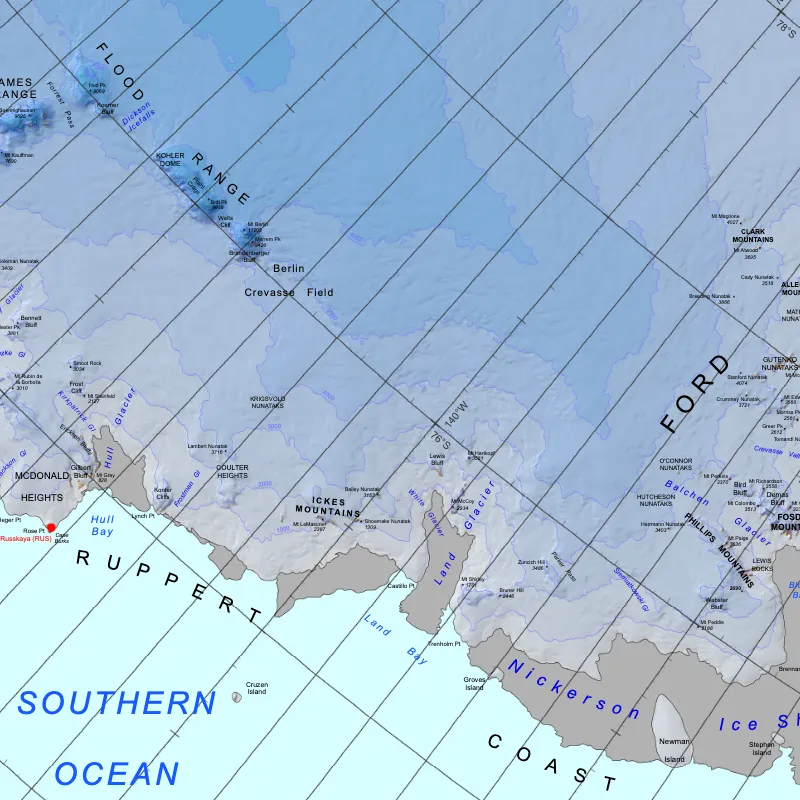
The Krigsvold Nunataks are a group of exposed rocky peaks at the head of Strauss Glacier in Marie Byrd Land. As nunataks, they rise above the surrounding ice sheet, providing fixed reference points within a dynamic glacial environment. Their position at the glacier head makes them scientifically useful: researchers can observe ice flow, accumulation, and seasonal variability against a stable rocky datum.
The Krigsvold Nunataks are the principal geographic anchor of the Count’s work. The arms of Krigsvold (Azure, a snowflake Argent, a chief invected Argent) encode the landscape directly: the blue field for Antarctic sky and water, the snowflake for the cryosphere, and the invected line of the chief for the nunatak ridge breaking through the ice.
The nunataks were named for Sgt. Alvin I. Krigsvold, in accordance with the Antarctic tradition of commemorating individuals associated with the exploration and support of polar science.
Rubin de la Borbolla
Mount Rubin de la Borbolla is a distinct mountain feature in Marie Byrd Land. It is the geographic basis of the Count’s second title, Count Rubin de la Borbolla, and represents a broader territorial and pedagogical role within the Count’s work. The title is associated with the processes of environmental observation and climate analysis, particularly the comparative and long-horizon questions that require looking beyond any single feature to regional and global patterns.
Mount Rubin de la Borbolla was named in 1974 by the Advisory Committee on Antarctic Names for George S. Rubin de la Borbolla, a meteorologist who served at Plateau Station in 1968. The Antarctic naming convention honoring researchers and support personnel reflects the dependence of polar science on sustained human presence in a difficult and remote environment.
Matikonis
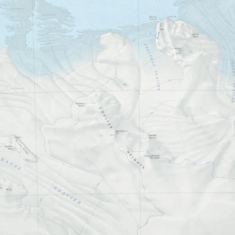
Matikonis Peak is located in the Coulter Heights in Marie Byrd Land. The Baron of Matikonis is the third and baronial title in the Count’s hierarchy, associated with the most focused and analytical dimension of the Count’s work: the glaciological and observational concerns that depend on the sustained, careful measurement of change in specific locations over time.
Nunataks like Matikonis Peak serve as longitudinal benchmarks for this kind of measurement. As the ice around them thickens or thins, as the patterns of accumulation and melt shift, as the glacier dynamics of the region evolve, fixed rocky features provide the reference frame against which change is measured.
Matikonis Peak was named for William P. Matikonis, consistent with the established practice of assigning personal names to prominent geographic features in Marie Byrd Land.
The Krigsvold Nunataks, Mount Rubin de la Borbolla, and Matikonis Peak are the Count’s territories. They are embedded in a landscape of global consequence, and the Count’s work proceeds from that fact.